
Maps & Townscapes
Hand-drawn and painted maps of Cape Cod, Martha’s Vineyard, Nantucket, Chappaquiddick and Cape Ann, plus colorful “townscapes” and laminated placemats to brighten any decor!
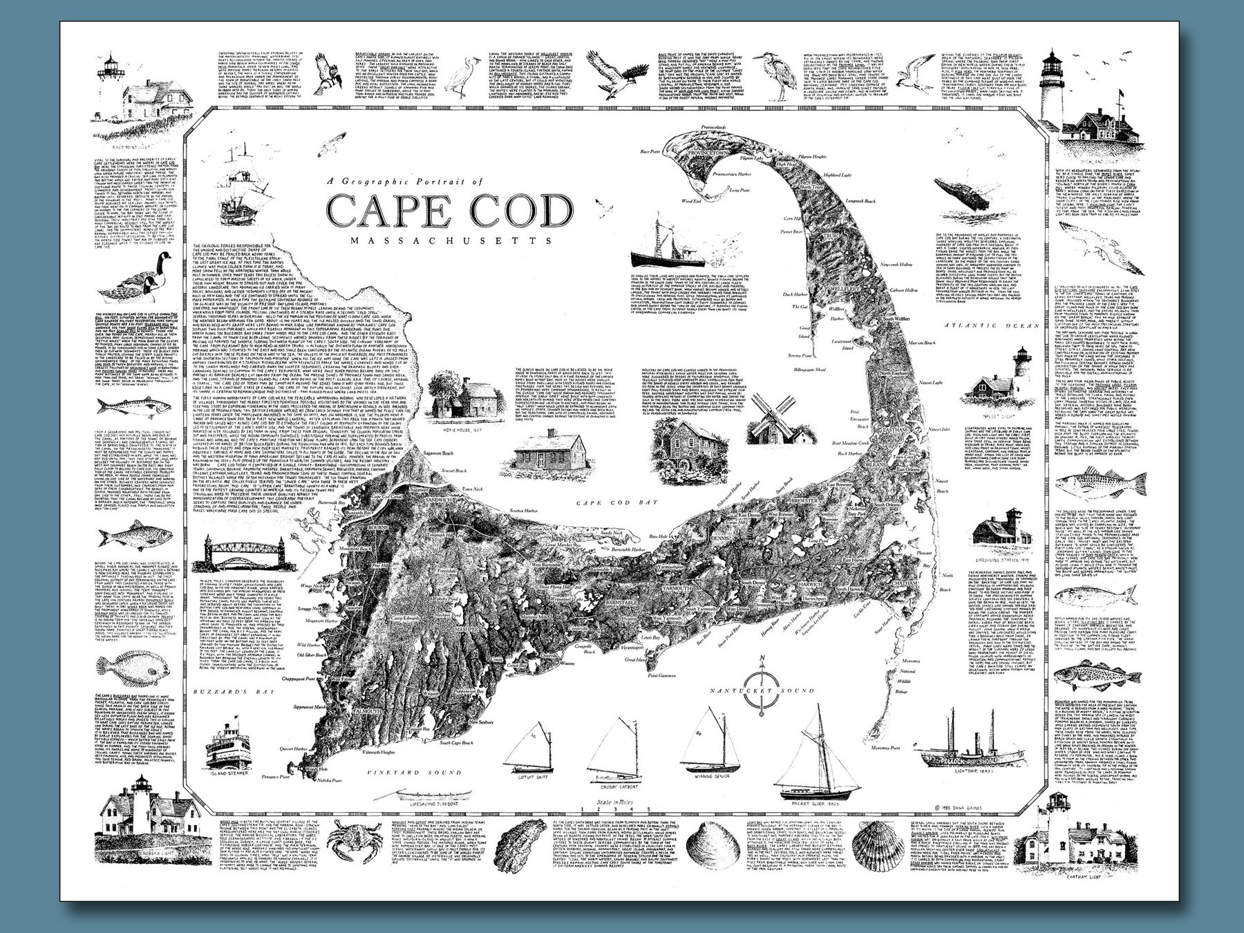
Hand-drawn and lettered in pen-and-ink, this intricate map highlights Cape Cod’s topography and glacial origins, in a pleasing composition which adds to any decor. A literal “book on one page”, the voluminous text informs and educates the viewer as to the Cape’s coastal geography, human settlement, and natural history. A best-seller since its initial publication in 1985! 22” x 28” print on off-white paper, fits in standard frames. Shipped rolled in cardboard tue and plastic sleeve.
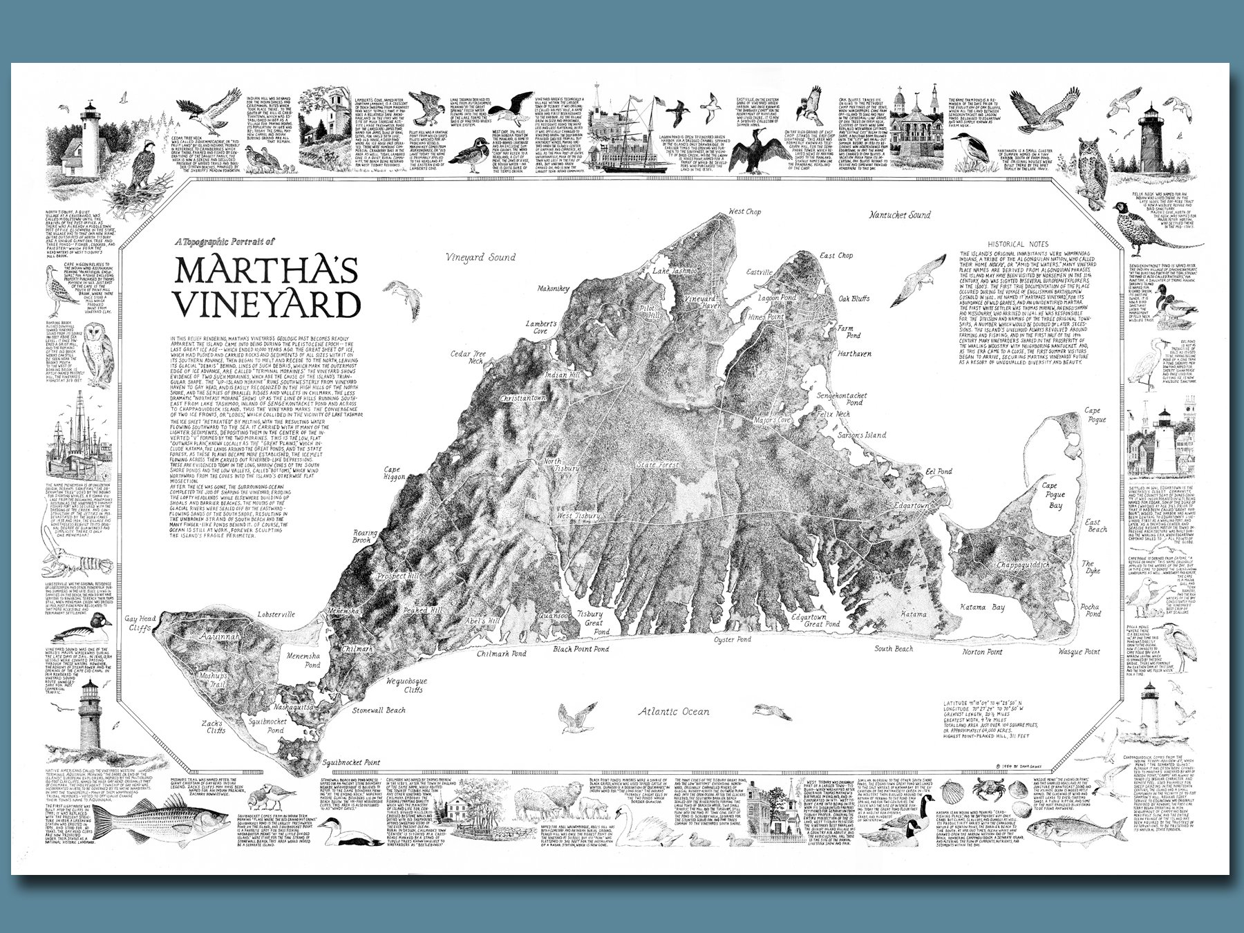
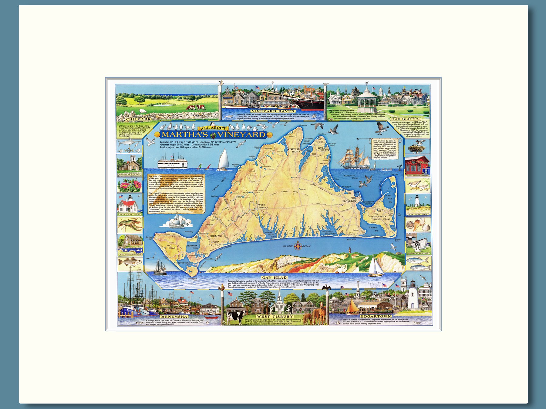
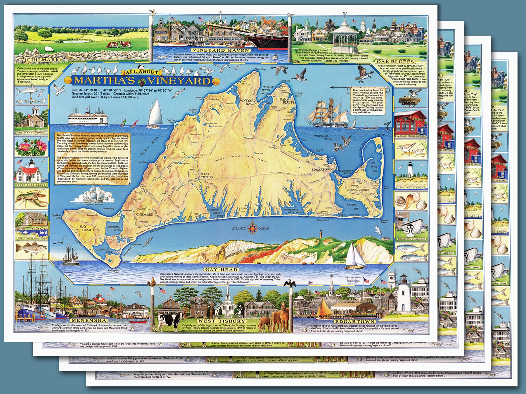
A painstakingly hand-drawn map of Martha’s Vineyard rendered in relief to highlight the island’s glacial origins, embellished with pen-and-ink illustrations of the region’s natural and human history. Exhaustive hand-lettered text creates a virtual “book on one page” which will fascinate readers and enhance any decor! 20” x 30” print on cream colored paper will fit in standard frames. Shipped rolled in cardboard tubing.
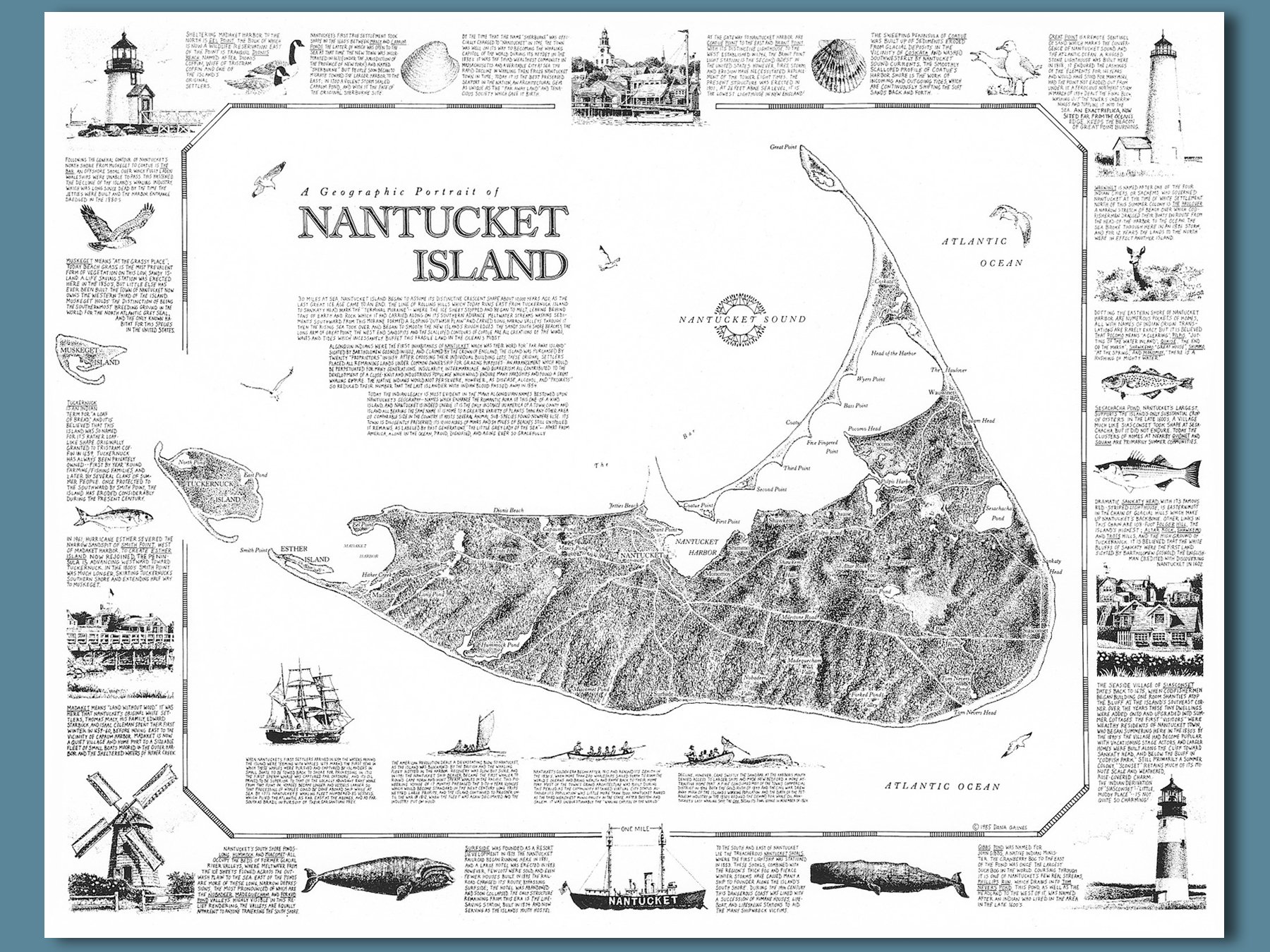
A painstakingly hand-drawn map of Nantucket rendered in relief to highlight the island’s glacial origins, embellished with pen-and-ink illustrations of the region’s natural and human history. Exhaustive hand-lettered text creates a virtual “book on one page” which will fascinate readers and enhance any decor! 18” x 24” print on cream colored paper will fit in standard frames. Shipped rolled in cardboard tubing.
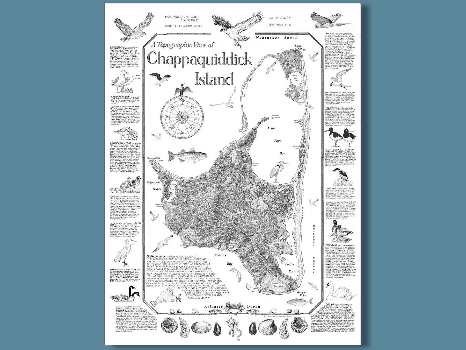
The first map I ever published, originally drawn in 1983 and re-released in 2011 with an updated topographical rendering. Created as a “test case” to see if the approach would be popular with a small but fiercely devoted customer base, it exceeded expectations and led to similar compositions of Martha’s Vineyard, Cape Cod and Nantucket. Utilizing USGS topo maps I developed a method for portraying light and shadow, leading to a three-dimensional effect; I was very “Chappy” with the result! 18” x 24” print on off-white paper, shipped rolled in cardboard tube and plastic sleeve.

A labor of love, 100% hand-drawn, painted and lettered in 2004….and a resounding success at that year’s Chappy Community Center fundraising auction. This intricate composition depicts all of the island’s familiar landmarks along with its abundance of wildlife,,, and serves as a “period piece” as well, since it includes the single bay firehouse and Wasque Point stairs and boardwalk— both since lost to the ages. Printed to order via the archival Giclée process (see below), signed and numbered by the artist in a limited edition of 500. Shipped rolled in plastic sleeve and heavy cardboard tube.
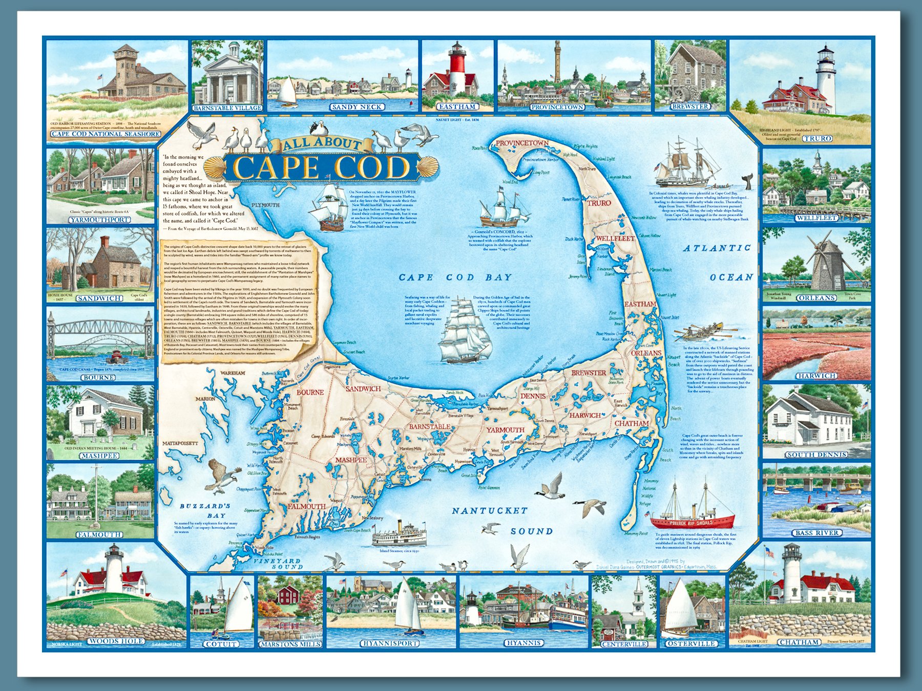
A colorful hand-painted map of Cape Cod, surrounded with vignettes of the peninsula’s 15 towns and numerous villages. Includes historical text, along with illustrations of famous ships and common waterbirds. Sure to enhance the decor of homes both on the Cape, and off! 18” h x 24”w, fits in standard frames. Shipped rolled in tube and clear sleeve.
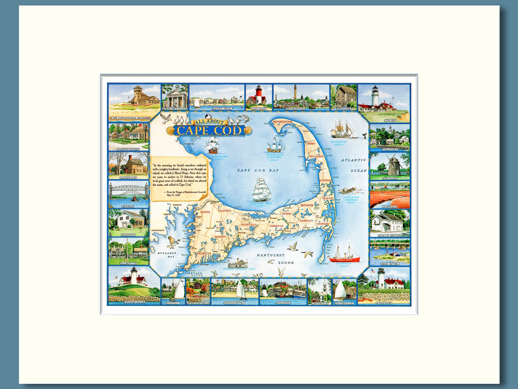
A smaller version of my 18” x 24” “All About Cape Cod” map, in a tasteful soft white mat for smaller spaces. 8” x 10” print in 11” x 14” mat, fits standard frames.
A vibrant and detailed depiction to the island with its towns and villages: Aquinnah, Chilmark, Edgartown, Oak Bluffs, Vineyard Haven, West Tisbury, Menemsha and Chappaquiddick. Voluminously illustrated with landmarks and cherished vistas. 8” x 10” print in 11” x 14” soft white mat, fits in standard frames.
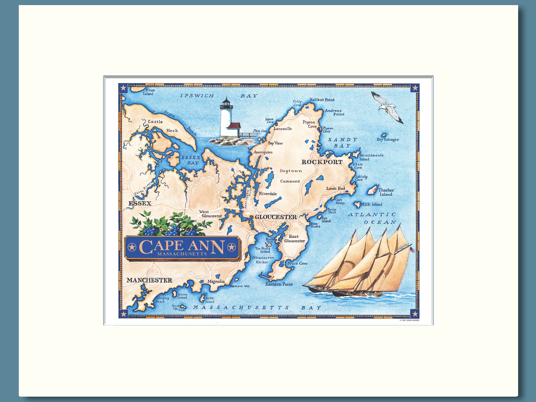
A colorful map of the Cape Ann peninsula, including the city of Gloucester, towns of Rockport, Essex and Manchester-by-the-Sea, and villages of Annisqaum, Bay View, East Gloucester, Lanesville, Magnolia, Pigeon Cove, Riverdale and West Gloucester. *’ x 10” print in soft white 11” x 14” mat, fits standard frames.

Heavy-duty placemats laminated placemats loaded with color and historical facts about Cape Cod and its 15 towns; in limited supply and available ONLY on this website…. every Cape table deserves a set! Shipped flat in packs of four.
Heavy duty laminated placemats bursting with color and historical information on the island and its six unique towns…. every Vineyard table deserves a set! Shipped flat in packs of four.
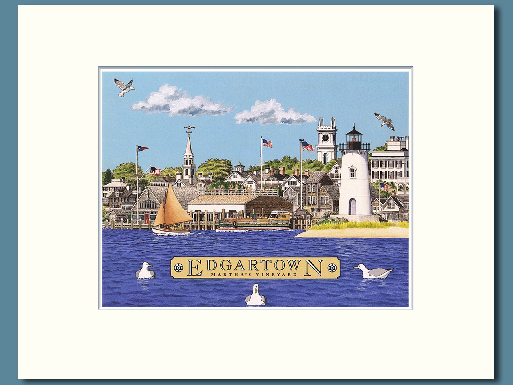
From my 1992 “All About Martha’s Vineyard” map illustration, a cheerful composition which includes Edgartown Light, Memorial Wharf, Edgartown Yacht Club, the Federated and Whaling Church spires, Chappy Ferry and a Herreshoff 12-1/2 gaff sloop. 8” x 10” print in a soft white 11” x 14” mat, fits standard frames.
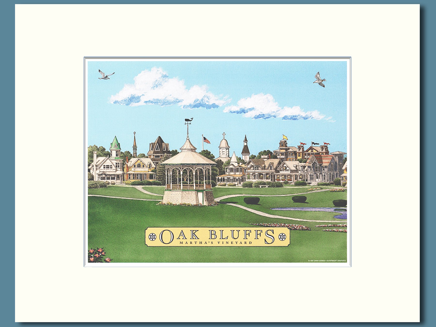
A detailed depiction of Oak Bluffs’ iconic bandstand and Ocean Park, derived from my 1992 “All About Martha’s Vineyard” map. Includes grand “Carpenter Gothic” cottages, plus the Union Chapel, Tabernacle dome, and spires of Our Lady Star of the Sea and Untied Methodist churches. 8” x 10” print in 11” x 14” soft white mat, ready-to-frame,
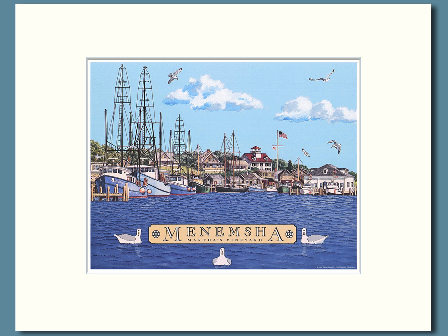
A colorful depiction of Menemsha Basin, derived from my 1992 “All About Martha’s Vineyard” map, which includes well-know fishing vessels of that era, the schooner BLUENOSE JR, classic shanties, and the Menemsha Coast Guard station and Boathouse. 8” x 10” print in 11” x 14” soft white mat, ready to frame.
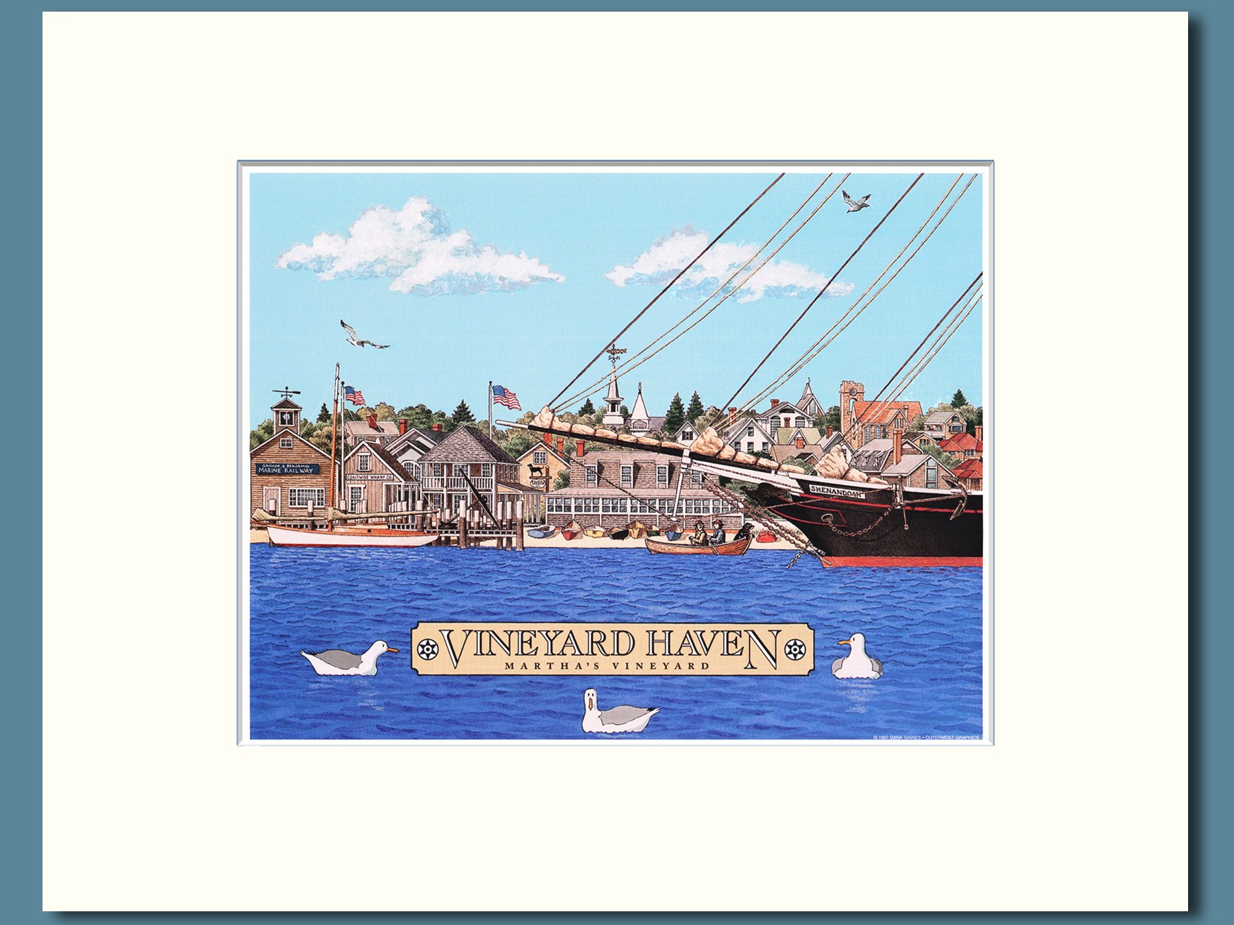
A mariner’s-eye-view of the Vineyard Haven waterfront which includes the Gannon & Benjamin Marine Railway, Coastwie Wharf Company and Black Dog Tavern, as well as the spires of the Katherine Cornell Theater and First Baptist, St. Augustine and Stone Churches. 8” x 10” print in 11” x 14” soft white mat, ready-to-frame.
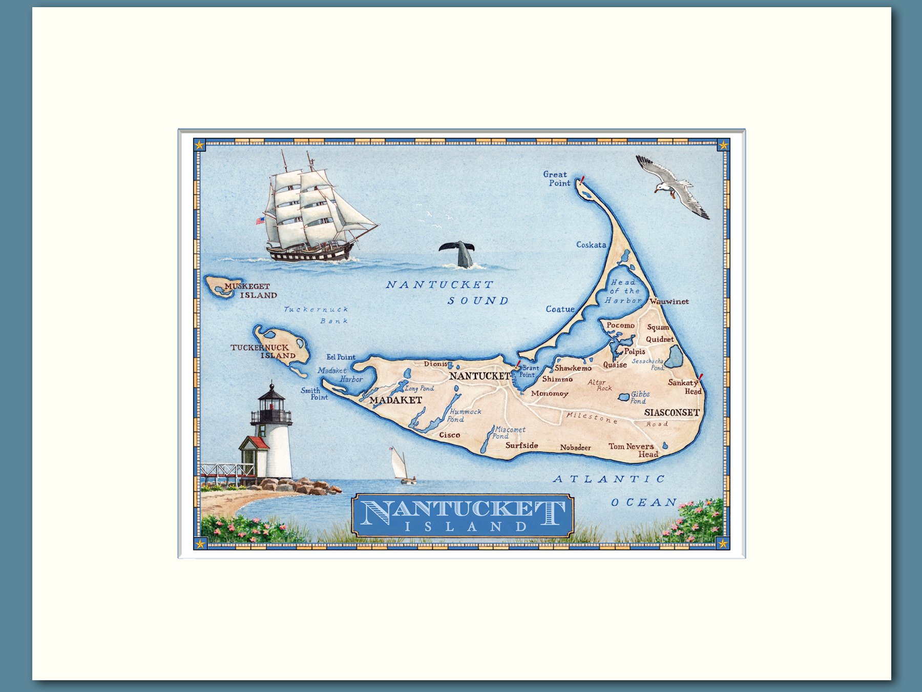
A hand-painted map locating all of Nantucket’s villages and neighborhoods, as well as nearby Tuckernuck and Muskeget Islands. Includes vignettes of a whaling ship and iconic Brant Point Lighthouse. In 11’ x 14” soft white mat, ready-to-frame.